Here are some of the pictures that should have been in the last couple of blog postings:
 |
| Pole climbing at Squamish Logging Day Event |
 |
| Log rolling - Squamish Logging Day Event |
 |
| Mask- Aboriginal Cultural Center, Whistler, BC |
 |
| Mask - Aboriginal Cultural Center, Whistler, BC |
 |
| Black Bear we 'met' on last hike of August Camp |
 |
| Giant Sitka Spruce at Hoh Rainforest |
 |
| Nursery log in Hoh Rainforest, Olympia National Park |
 |
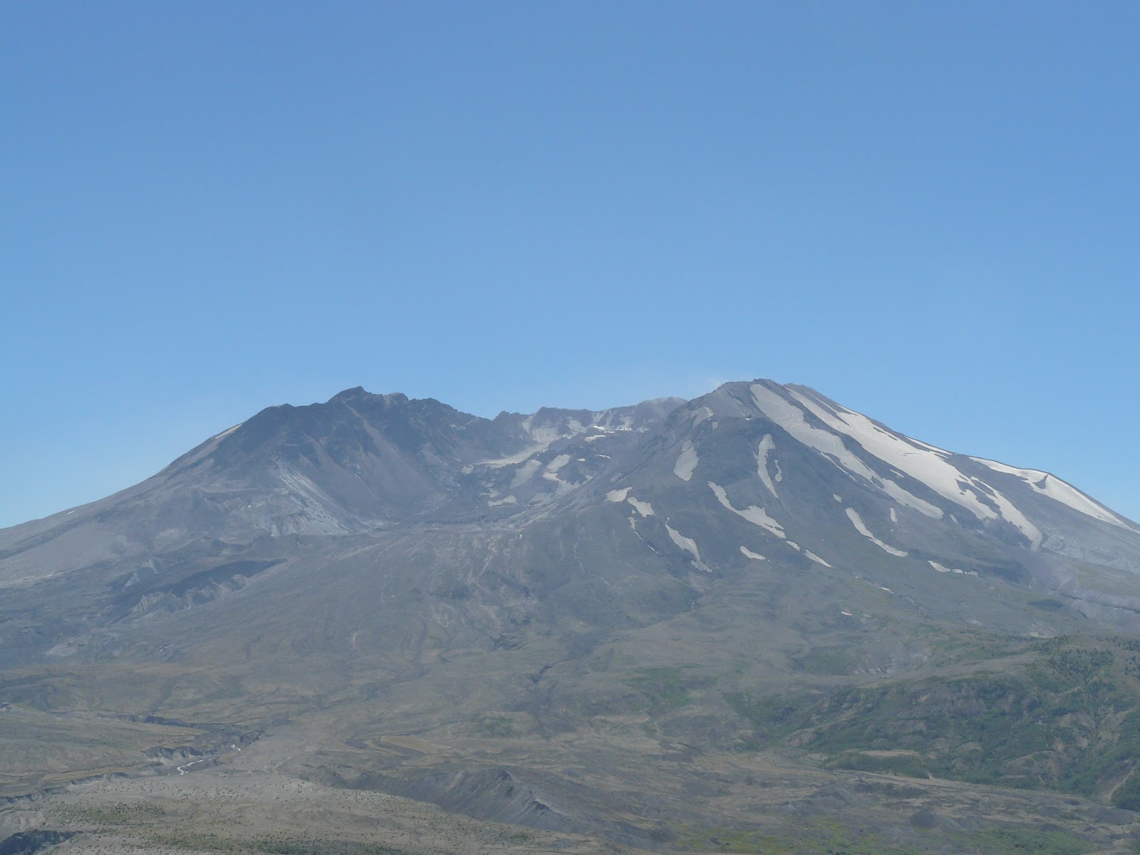
| Mt. St. Helens |
 |
| Astoria Column, Astoria, OR |
 |
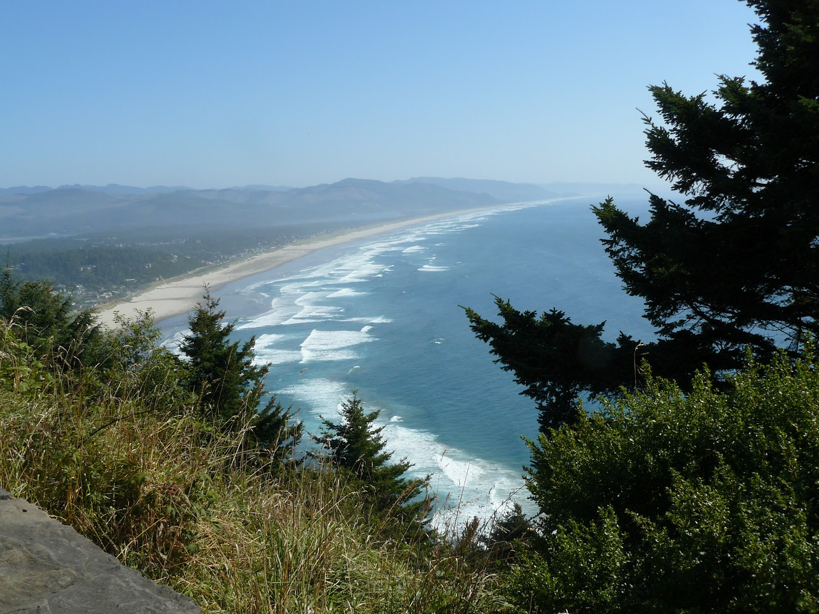
| Miles & miles of beaches - Oregon coast |
 |
| Another section of Oregon coastline |
 |
| The Spruce Goose |
 |
| Yaquina Head Lighthouse |
8/18/12
Today was a day of driving and stopping as we traveled along
the Columbia River Scenic Highway. The
western end of the highway is picked up just east of Portland, Oregon. The drive is located on the borders of Washington
and Oregon. The western end is lush and
green; we saw numerous waterfalls and towering cliffs. The landscape changed as we drove further up
the Columbia becoming less treed and somewhat less green. By the
time we got to the eastern most part of the river (before it turns northward
into Washington state) the had flattened and become arid and almost
desert-like. Along the borders of the
two states the Columbia has five dams, some with locks to allow shipping up the
river. These five dams supply 1/3 or 1/2
of all the hydroelectric power produced in the US. We stopped at Bonneville, the first dam ,where
we were given a lot of information about the dam being built, the spillways and
the effect they can have on salmon, and the salmon ladders which (supposedly)
allow the salmon to return up stream to their spawning grounds. (According to a PBS show I saw in the Pacific
Salmon before we left, the fish program is not really working and supposedly
several of the dams further up river have been removed to try to reverse the
decreasing numbers of salmon.) We
crossed the River twice to allow us visuals of both sides of the
'palisades'. Our crossover from
Washington back into Oregon afforded us a beautiful view of a snow-covered Mt.
Hood directly in front of us. We stopped
for the night at a place called The Dalles, Oregon (another dam site).
 |
| Horsetail Falls, Columbia River Scenic Highway |
 |
| Bonneville Dam spillway, Columbia River Scenic Highway |
8/19/12
Eastern Oregon was a surprise to both of us. The land was covered with dried grass and
sagebrush - almost desert. As we drove
along, we came upon farms, a lot of wheat being grown in the area and, at this
time of year, golden brown and ready for harvesting. These farmlands are there because of irrigation. We saw a tree farm that stretched for miles
and miles (width and depth) - as far as the eye could see.
As we approached Wallowa Lake State Park in eastern
Oregon, a deep haze lay over the
mountains which turned out to be smoke from the forest fires in Idaho. We are camping at Wallowa Lake SP for the
next several days to unwind and regroup.
As we were getting settled, we had visitors--4 young buck mule deer idles around our
campsite obviously looking for a 'handout'.
They still had the velvet on their three and four point antlers. The next morning, two or three young does decided to visit us.
 |
| Young mule deer that visited our campsite |
 |
| Sunset our first night at Wallowa Lake State Park |
8/20/12
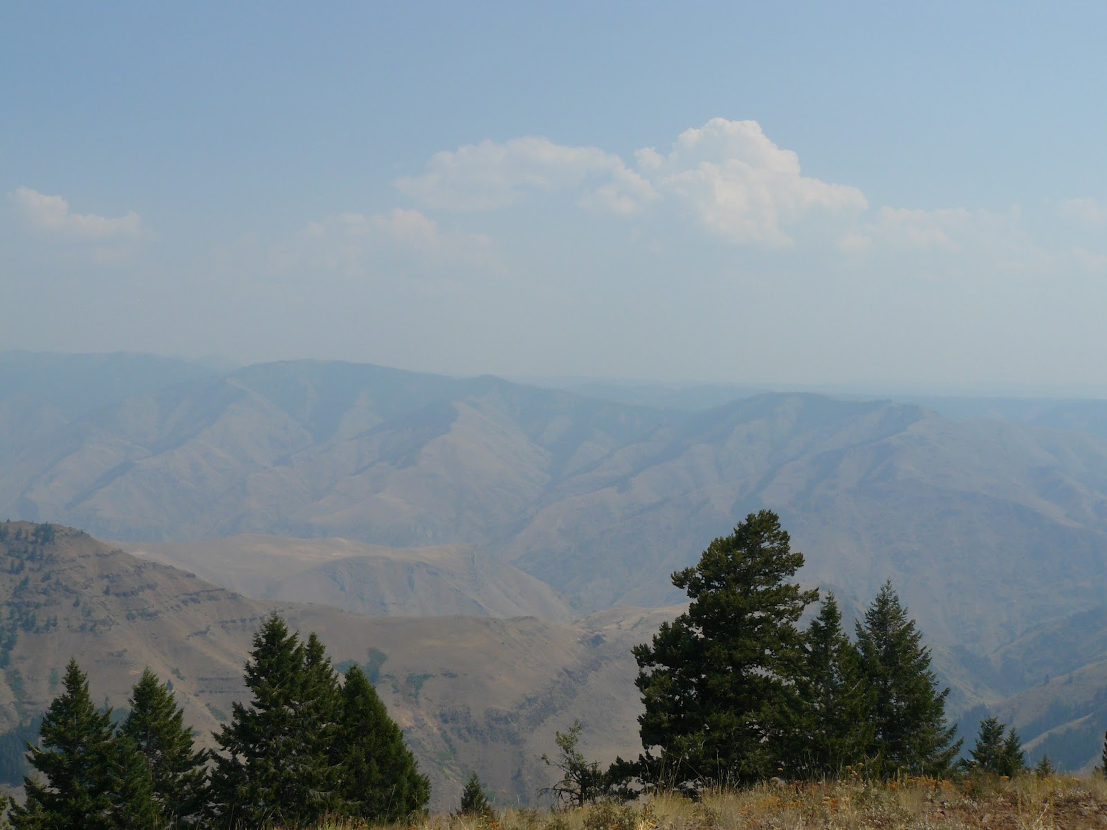
It was good to wake up and not have to pack up and go. Hells
Canyon is located between the borders of Oregon and Idaho and stretches south
for a t least 100 miles. The smoky haze
from yesterday persisted and allowed limited views of the area. The gorge is so deep (7,500 feet - deeper
than the Grand Canyon) we couldn't see the Snake River that runs through
it.
 |
| A very smokey view of Hell's Canyon |
8/21/12
Day two at Wallowa Lake SP was a day of rest except for the hike we took on the Chief Joseph Trail. It was rather rocky and steep but we made it fine. The western branch of the Wallowa as it cascaded down the rocks and ravine was visible several times as was the Wallowa Lake. The day was a little warm but beautiful. Our nights at the campsite were cool, the last night being downright cold.
 |
| West branch of Wallowa River |
 |
| Wallowa Lake from the trail |


Love how close you were to that mule deer!
ReplyDelete